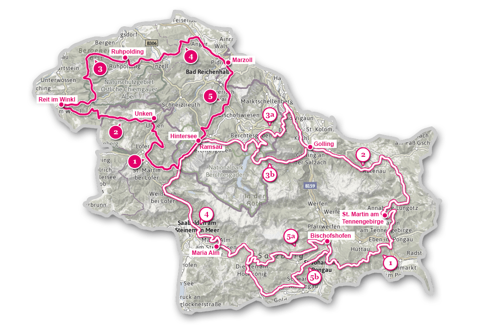
Stages
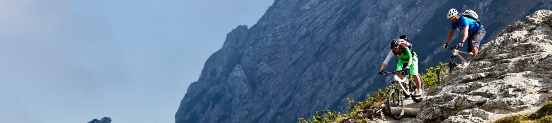
The whole route comprises a northern and southern loop, each of which is divided into five stages. Climbing to almost 8,000 metres, the southern loop is a real challenge. Reaching a height of 3,800 metres, the "gentler" northern loop is also divided into five daily stages, but the fittest cyclists manage it in just three days!
North-Loop: Stage 1: Hintersee – Unken
Length: 35,5 km
Start: Hintersee
Destination: Unken
The first stage from Ramsau to Unken ensures with the idyllic Hintersee and Berchtesgaden National Park, right at the beginning for some great highlights. At the Birschbichl begins the "proper" mountain bike trail of this stage, which leads down to Lofer via Litzlalm and Wildental. On the way to Unken, the views at the "Jagasitz" and Obermayrberg are the next highlights.
Show map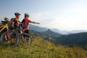
North-Loop: Stage 2: Unken – Reit im Winkl
Length: 26,4 km
Start: Unken
Destination: Reit im Winkl
This stage between Unken and Reit im Winkl crosses the state border again, switching sides from Bavaria to the SalzburgerLand! The ascent behind the Friedlwirt - follows an extensive forest tour to the Winklmoosalm, from which we - away from roads along forest paths - cycle down to Reit im Winkl.
Show map
North-Loop: Stage 3: Reit im Winkl - Ruhpolding
Length: 33 km
Start: Reit im Winkl
Destination: Ruhpolding
A real mountain tour; because as soon as we leave the romantic Weitsee, the route continue from Alpine pasture to Alpine pasture: Röthelmoosalm, Hinteralm, Gleichenbergalm and Steinbergalm all lie on the way to Ruhpolding.
Show map
North-Loop: Stage 4: Ruhpolding – Marzoll
Length: 34 km
Start: Ruhpolding
Destination: Marzoll
With only 450 altitude meters is this the "gentlest" of all stages of the Watzmann-Hochkönig Loop. It connects the two famous winter sports resorts, Ruhpolding and Inzell, before it leads via the Inzeller Höhe of the striking Staufen-Massiv around the north side.
Show map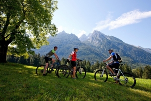
North-Loop: Stage 5: Marzoll - Hintersee
Length: 24,5 km
Start: Marzoll
Destination: Hintersee
A mostly Bavarian tour with a short Austrian section; because just after launching in Marzoll the route goes beyond the border up to the Latschenwirt and to Wolfschwang, before we return to the Berchtesgadener land. The ascent - with Tragepassagen (passages) - up to Mordau-Alm will be rewarded with magnificent view!
Show map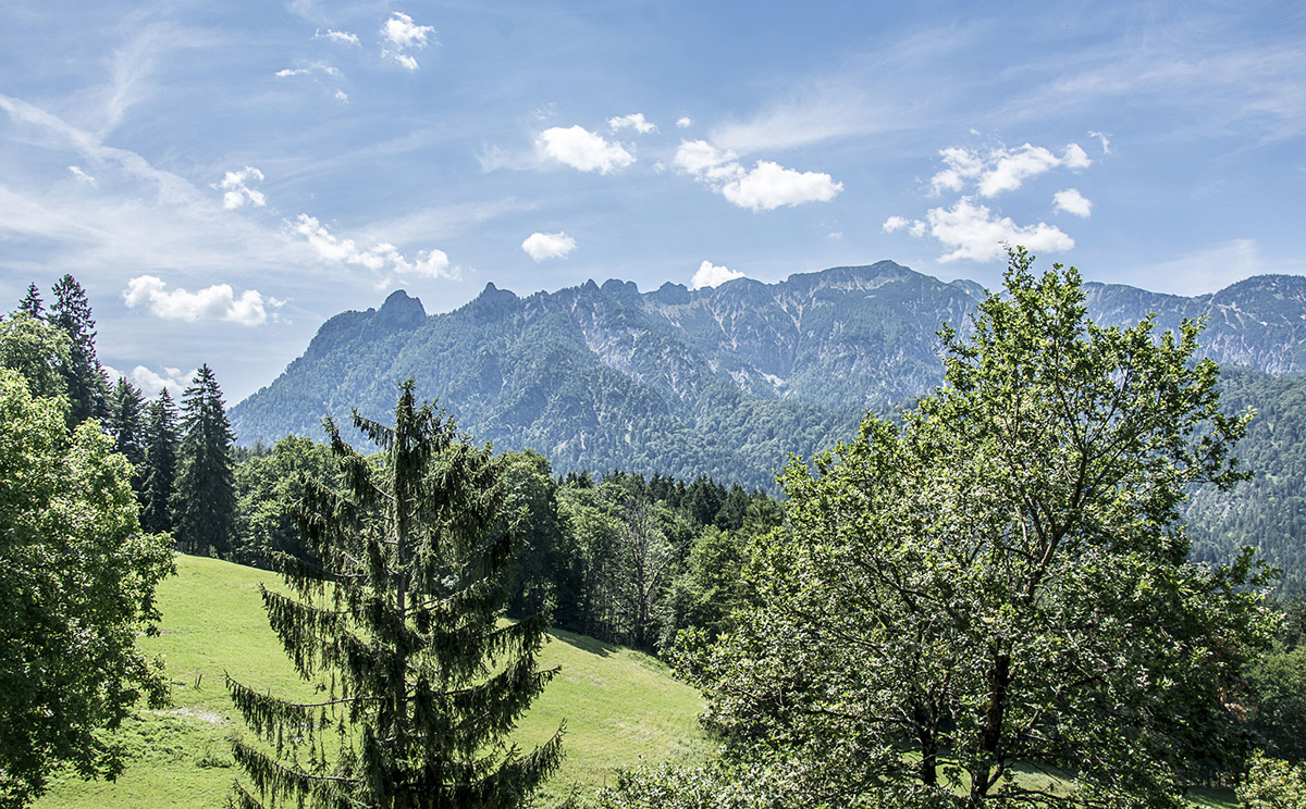
North-Loop: Stage 5b: E-bike variant
Length: 26,5 km
Start: Marzoll
Destination: Ramsau / Hintersee
This variant of the 5th stage of the North-Loop of the Watzmann Hochkönig Runde avoids the sliding section to Mordau and instead leads over the Hochschwarzeck to the Hintersee.
Show map
South-Loop: Stage 1: Bischofshofen – St. Martin am Tennengebirge
Length: 54,1 km
Start: Bischofshofen
Destination: St. Martin am Tennengebirge
With approximately 2150 metres above sea level is this stage, the stage with the most climbs! Already the first section from Bischofshofen leads steepls uphill to the Heinrich-Kam-Haus and the St. Vinzenz Peace church. Here we reach the highest point of the Watzmann-Hochkönig tour at 1792 m above sea level. The descent leads on forest paths down to Eben after which there is again a climb to St. Martin am Tennengebirge again.
Show map
South-Loop: Stage 2: St. Martin – Golling
Length: 51,7 km
Start: St. Martin
Destination: Golling
This stage strings together some shorter ascents, which accumulate to a 1000 m in total. Enjoyable are the sections directly along the river Lammer, tempting the many refreshment stops in Lungötz, Annaberg, Abtenau, Scheffau and at the Golling marketplace!
Show map
South-Loop: Stage 3: Golling – Ramsau/Hintersee
Length: 65,8 km
Start: Golling
Destination: Ramsau/Hintersee
A varied stage. The stage begins with the Tauern Bike tour to Hallein as an introduction, where it then continue up to Bad Dürrnberg and - very steep - onto the Zinkenkogel. Completely different is the subsequent trip along the promising Roßfeld Höhenstraße (road) with magnificent views of the Salzach River Valley and the Göllmassiv. We then continue on old logging roads down to the Königssee and the Scharitzkehlalm to Hintersee.
Show map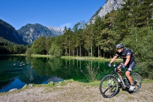
South-Loop: Stage 3: Variant via Bluntautal and C. v. Stahl Haus
Length: 45,1 km
Start: Golling
Destination: Ramsau/Hintersee
For those that can muster the effort, can choose this route, a more strenuous variation via the bluntautal (valley) and the Carl-von-Stahl-Haus. However, for the last 330 vertical metres up to the Oberen Jochalm one must push! Exhausting, but the reward that follows on the sun terrace of the steel House overlooking the impressive Watzmann, is worth it. After a steep descent, the route continues above the Königssee, until we meet again on the main route.
Show map
South-Loop: Stage 4: Hintersee - Maria Alm
Length: 41,6 km
Start: Hintersee
Destination: Maria Alm
The shortest stage of the South loop has its challenges with the steep ascent to the Hirschbichl and the bike route between Saalfelden and Maria Alm. Steep – up to 30% - is descent from Hirschbichl to Weissbach, while the route along the Tauern Bike Tour to Saalfelden is relaxing.
Show map
South-Loop: Stage 5: Maria Alm – Bischofshofen
Length: 54,7 km
Start: Maria Alm
Destination: Bischofshofen
On this stage, we almost always the eponymous Hochkönig in our line of sight. The further we cycle around him, the more impressive is the view of this huge mountain massif. The inviting pastures along the route around the three towns in the region are numerous: Maria Alm, Dienten and Mühlbach am Hochkönig!
Show map
South-Loop: Stage 5: Variant via St. Veit im Pongau
Length: 58,3 km
Start: Maria Alm
Destination: Bischofshofen
This alternative branches, shortly before Dienten, away from the original route (stage 5a South) and has around 200 meters less to climb. Especially the idyllic Böndlsee, the ride along the so-called 'Sun Terrace of Salzburg' to St. Veit im Pongau and the subsequent climb to the Pronebenalm have their special charm.
Show map