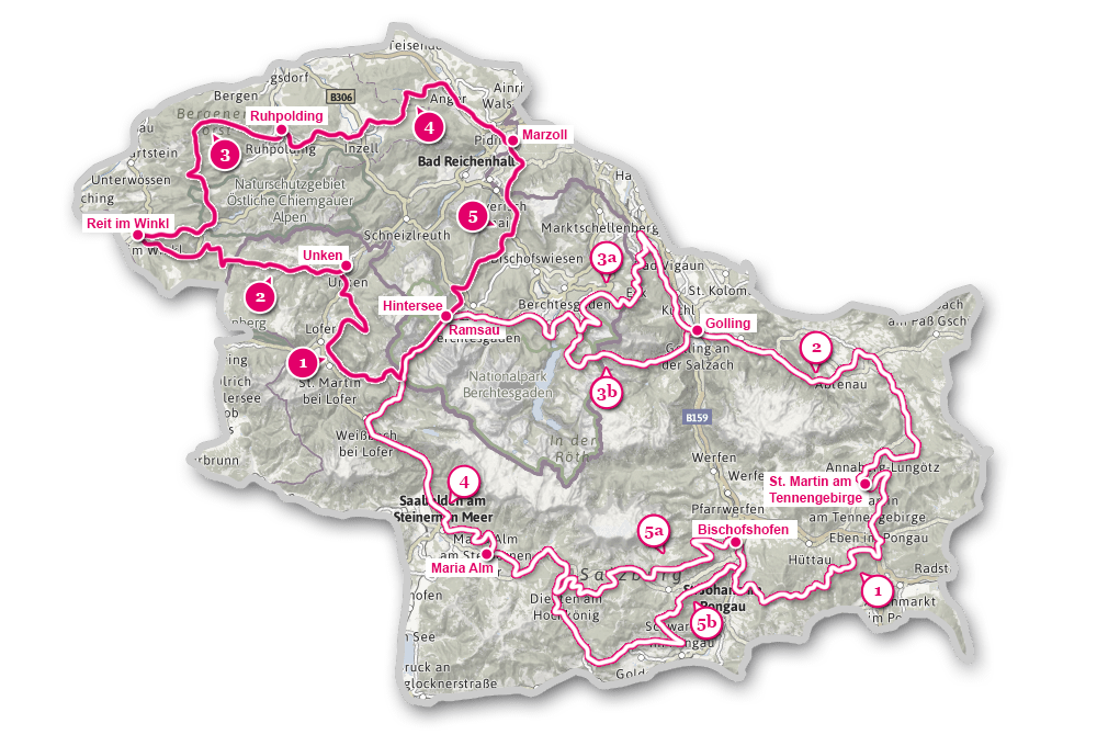
Etappen
Etappen der Watzmann Hochkönig Runde
Der Gesamtverlauf gliedert sich in eine nördliche und südliche Schleife, beide sind in jeweils 5 Etappen eingeteilt. Mit fast 8.000 Höhenmetern ist die südliche Schleife eine echte Herausforderung. Auch die „sanftere“ nördliche Schleife mit fast 3.800 Höhenmetern ist in fünf Tagesetappen eingeteilt, sehr Sportliche schaffen sie sogar in 3 Tagen!
Nord-Runde: Etappe 1: Hintersee – Unken
Länge: 35,5 km
Start: Hintersee
Ziel: Unken
Die erste Etappe von Ramsau bis Unken sorgt mit dem idyllischen Hintersee und dem Nationalpark Berchtesgaden gleich am Beginn für die ersten Highlights. Am Hirschbichl beginnt der „richtige“ Mountainbiketeil dieser Etappe, der über Litzlalm und Wildental hinunter nach Lofer führt. Auf dem Weg nach Unken sind die Aussicht beim „Jagasitz“ und Obermayrberg die nächsten Höhepunkte.
Karte anzeigen
Nord-Runde: Etappe 2: Unken – Reit im Winkl
Länge: 26,4 km
Start: Unken
Ziel: Reit im Winkl
Auch diese Etappe zwischen Unken und Reit im Winkl überquert wieder die Staatsgrenze und wir wechseln vom SalzburgerLand nach Bayern! Dem steilen Anstieg hinter dem Friedlwirt folgt eine ausgedehnte Wald-Tour zur Winklmoosalm, von der wir - immer abseits der Straße auf Waldwegen - hinunter bis Reit im Winkl radeln.
Karte anzeigen
Nord-Runde: Etappe 3: Reit im Winkl – Ruhpolding
Länge: 33 km
Start: Reit im Winkl
Ziel: Ruhpolding
Eine richtige Almen-Tour. Denn sobald wir den romantischen Weitsee verlassen haben, geht’s von Alm zu Alm: Röthelmoosalm, Hinteralm, Gleichenbergalm und Steinbergalm liegen auf dem Weg nach Ruhpolding.
Karte anzeigen
Nord-Runde: Etappe 4: Ruhpolding – Marzoll
Länge: 34 km
Start: Ruhpolding
Ziel: Marzoll
Mit nur 450 Höhenmetern die „sanfteste“ aller Etappen der Watzmann-Hochkönig-Runde. Sie verbindet zunächst die beiden bekannten Wintersportorte Ruhpolding und Inzell miteinander, ehe sie dann über die Inzeller Höhe das markante Staufen-Massiv auf der Nordseite umrundet.
Karte anzeigen
Nord-Runde: Etappe 5: Marzoll – Hintersee
Länge: 24,5 km
Start: Marzoll
Ziel: Hintersee
Eine überwiegend bayerische Tour mit einem kurzen österreichischen Abschnitt. Denn gleich nach dem Start in Marzoll geht’s jenseits der Grenze hinauf zum Latschenwirt und nach Wolfschwang, ehe wir wieder ins Berchtesgadener Land zurückkehren. Der Anstieg – mit Tragepassagen – hinauf zur Mordau-Alm wird mit der grandiosen Aussicht auf der Alm belohnt!
Karte anzeigen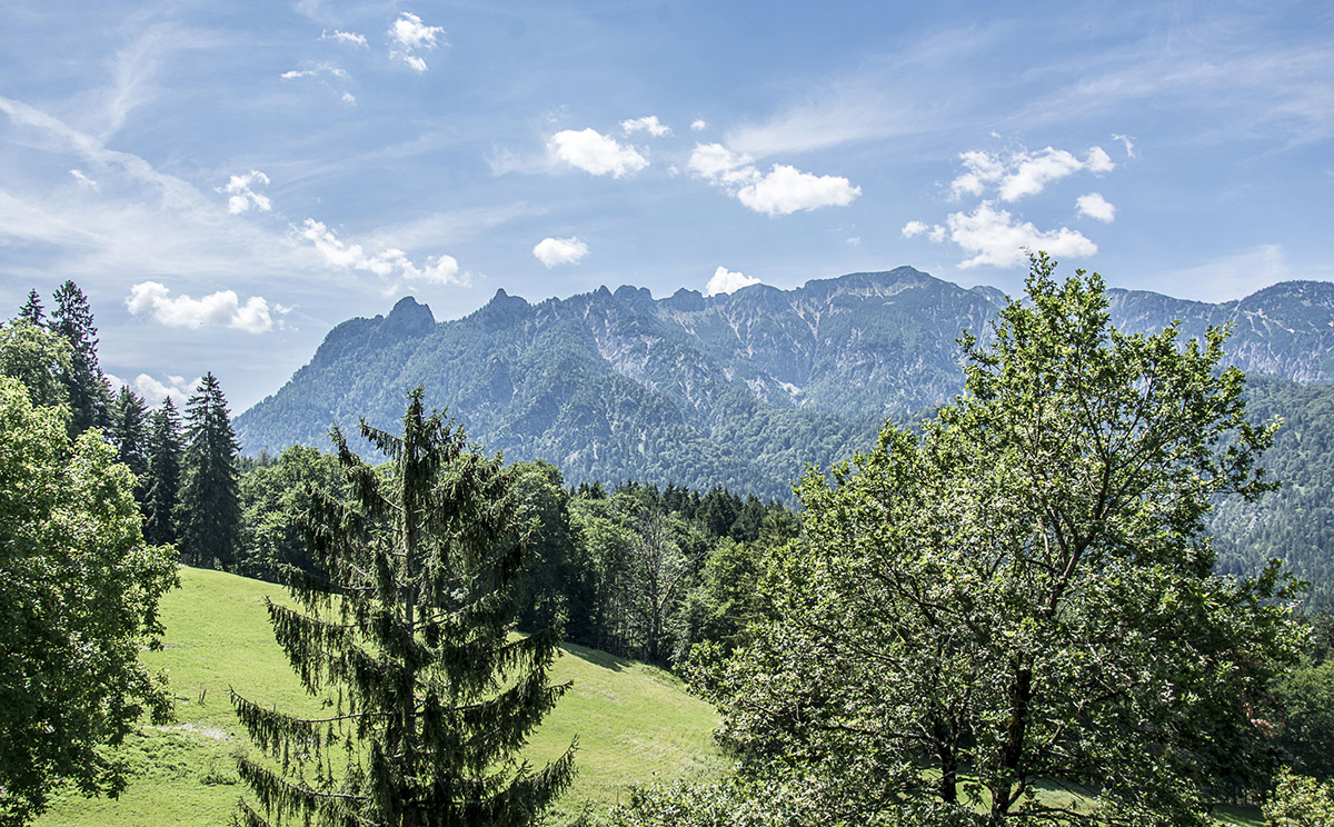
Nord-Runde: Etappe 5b: E-Bike Variante
Länge: 26,5 km
Start: Marzoll
Ziel: Ramsau / Hintersee
Diese Variante der 5. Etappe der Nordschleife der Watzmann Hochkönig Runde vermeidet die Schiebestrecke zur Mordau und führt stattdessen über das Hochschwarzeck zum Hintersee.
Karte anzeigen
Süd-Runde: Etappe 1: Bischofshofen – St. Martin am Tennengebirge
Länge: 54,1 km
Start: Bischofshofen
Ziel: St. Martin am Tennengebirge
Mit rund 2150 Höhenmetern die Etappe mit den meisten Anstiegen! Denn gleich der erste Abschnitt führt von Bischofshofen steil hinauf zum Heinrich-Kiener-Haus und dem St. Vinzenz Friedenskirchlein gleich nebenan. Hier erreichen wir mit 1792 m den höchsten Punkt der Watzmann-Hochkönig-Runde. Nach der langen Abfahrt auf Forstwegen hinunter nach Eben folgt bis St. Martin am Tennengebirge nochmals eine Bergwertung.
Karte anzeigen
Süd-Runde: Etappe 2: St. Martin – Golling
Länge: 51,7 km
Start: St. Martin
Ziel: Golling
Diese Etappe reiht einige kürzere Anstiege aneinander, die sich in Summe dann auf 1.000 Höhenmeter addieren. Genussvoll sind die Abschnitte direkt entlang der Lammer, verlockend die zahlreichen Einkehrmöglichkeiten in Lungötz, Annaberg, Abtenau, Scheffau und am Gollinger Marktplatz!
Karte anzeigen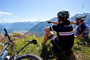
Süd-Runde: Etappe 3: Golling – Ramsau/Hintersee
Länge: 65,8 km
Start: Golling
Ziel: Ramsau/Hintersee
Eine sehr abwechslungsreiche Etappe. Sie beginnt mit dem Tauernradweg bis Hallein zum Einradeln, dann folgt der Abschnitt hinauf nach Bad Dürrnberg und – sehr steil - auf den Zinkenkogel. Gänzlich anders präsentiert sich die anschließende Fahrt auf der aussichtsreichen Roßfeld Höhenstraße mit grandiosen Ausblicken in das Salzachtal und auf das Göllmassiv. Dann auf den alten Forststraßen zur Scharitzkehlalm, hinunter zum Königssee und weiter zum Hintersee.
Karte anzeigen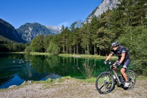
Süd-Runde: Etappe 3: Variante über Bluntautal und C. v. Stahl Haus
Länge: 45,1 km
Start: Golling
Ziel: Ramsau/Hintersee
Wer genug Schmalz in den Waden besitzt, kann diese direkte, aber umso anstrengendere Variante über das Bluntautal und das Carl-von-Stahl-Haus wählen. Die letzten 330 Höhenmeter von der Oberen Jochalm hinauf sind allerdings eine Schiebe- bzw. Tragestrecke! Anstrengend, doch die Belohnung folgt auf der Sonnenterrasse des Stahl-Hauses mit dem Ausblick auf den imposanten Watzmann. Nach steiler Abfahrt geht’s oberhalb des Königssees entlang, bis wir wieder auf die Hauptroute treffen.
Karte anzeigen
Süd-Runde: Etappe 4: Hintersee – Maria Alm
Länge: 41,6 km
Start: Hintersee
Ziel: Maria Alm
Die kürzeste Etappe der Südschleife hat mit dem steilen Anstieg zum Hirschbichl und der Bikestrecke zwischen Saalfelden und Maria Alm auch ihre Herausforderungen. Steil – bis zu 30 % - ist die Abfahrt vom Hirschbichl bis Weißbach, erholsam die folgende Strecke am Tauernradweg bis Saalfelden.
Karte anzeigen
Süd-Runde: Etappe 5: Maria Alm – Bischofshofen
Länge: 54,7 km
Start: Maria Alm
Ziel: Bischofshofen
Auf dieser Etappe haben wir fast immer den namensgebenden Hochkönig im Blickfeld. Je mehr wir ihn umrunden, umso eindrucksvoller ist die Aussicht auf dieses gewaltige Gebirgsmassiv. Zahlreich sind die einladenden Almen entlang der Route rund um die drei Orte der Region: Maria Alm, Dienten und Mühlbach am Hochkönig!
Karte anzeigen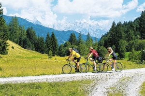
Süd-Runde: Etappe 5: Variante über St. Veit im Pongau
Länge: 58,3 km
Start: Maria Alm
Ziel: Bischofshofen
Diese Alternative verlässt kurz vor Dienten die Originalstrecke (Etappe Süd 5a) ab und weist rund 200 Höhenmeter weniger auf. Vor allem der idyllisch gelegene Böndlsee, die Fahrt auf der sogenannten Salzburger Sonnenterrasse bis St. Veit im Pongau und die anschließende Bergwertung hinüber zur Pronebenalm haben ihren besonderen Reiz.
Karte anzeigen